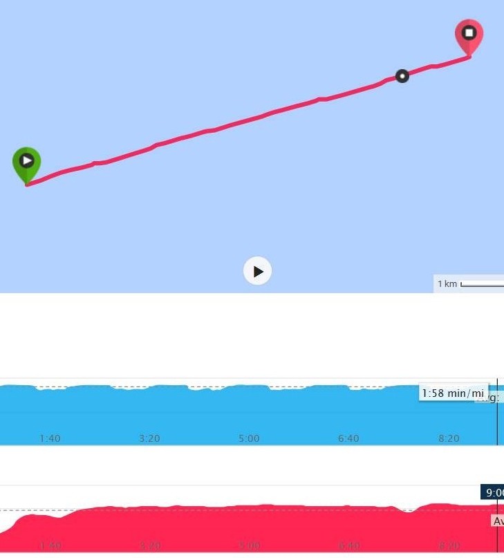
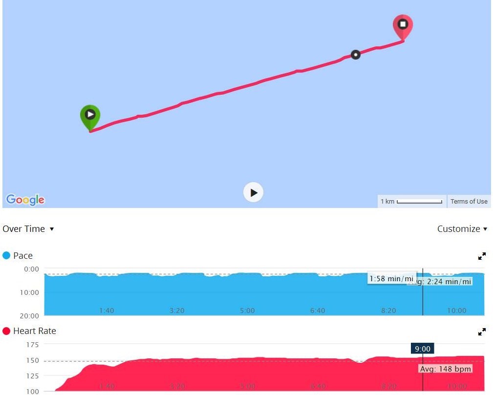
I went for a run earlier this week. You will note that my jogging route was not precisely a straight line – it has some subtle blips in it. Can you determine where I was and what I was doing? I’ll provide a copy of my ISS mission patch to the first person with the correct answer.
Hint: My starting point (green marker) was at latitude 47°02.442’N and longitude 31°32.466’W. Elevation was 62m.


I’m guessing your jogging route. I believe it was the Potemkin Stairs in Odessa, Ukraine.
Hmmm! Mid-Atlantic. 62m implies that you were on the deck of a liner. Distance 7.5 km with a blip at each km. Slight change of pace every 500 metres. I’m guessing that you were jogging around the deck of the ship which was approximately 500 metres on a side.
Well done, Dave. I was on a transAtlantic crossing last week aboard the Queen Mary 2 (a magnificent Cunard ship) from New York City to Southampton. This trip had been on my to-do list for some time. My wife and I went for a run or brisk walk around the outside deck at least once a day to burn off some of the calories from the sumptuous onboard meals.
The ship was traveling at 21 knots towards Southampton. Therefore my running pace was a bit faster than that when I ran toward the bow and a bit slower when I ran toward the stern.
Congrats. I’ll put an ISS mission patch in the mail to you.
Bob
Elementary, my dear Bob!
Glad that you got to do that since it must be on the bucket list of approximately 50% of the population of USA/Canada and Europe. My wife and I would certainly like to have the experience (but only when the atlantic is dead calm – I am not a good sailor!).
David